Huatoki Stream
New Plymouth Urban Catchment · Taranaki · Ngāti Te Whiti Rohe
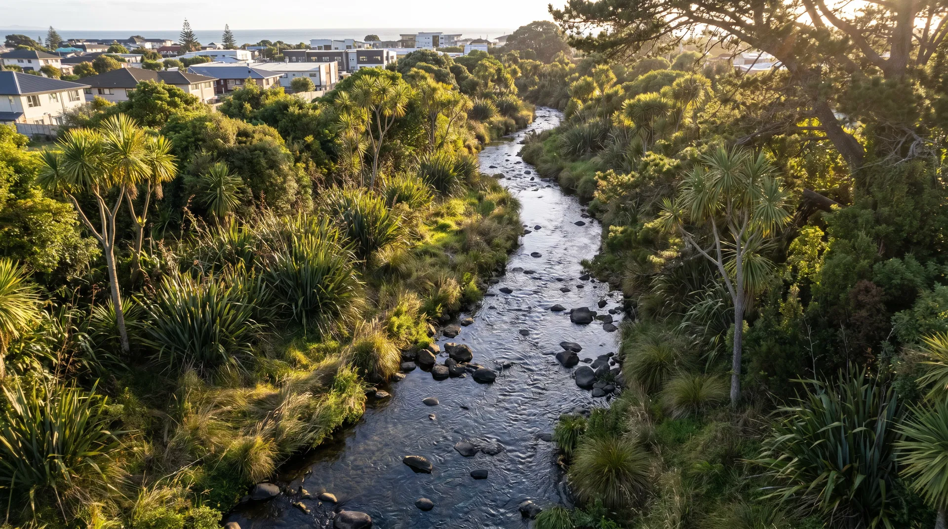
The Huatoki is a short, steep coastal stream that drains the urban and semi-rural fringe of New Plymouth before discharging to the Tasman Sea. It is fed by volcanic soils from the Taranaki ring plain and carries the characteristic dark cobble substrate of Taranaki waterways.
Unlike most Taranaki rivers, the Huatoki flows directly through the city centre — making it one of the few urban streams in the region with a confirmed longfin tuna population and a 30-year scientific monitoring record.
In April 2026, Metro Plaza was demolished as part of New Plymouth's first-ever public-private partnership for urban stream restoration. The section of the Huatoki culverted underground since 1929 is being exposed to daylight for the first time in nearly a century.
NPDC is partnering with KDH Holdings (adjacent developer) and Ngāti Te Whiti hapū in an awa-centric approach — goals and principles for the restoration were set in partnership with the hapū before any design work began.
No ecological baseline exists for the daylighted reach. The first student Wai Care survey here will be a genuine scientific first — Year 0 data that future groups will compare against.
- Species ID quiz — invertebrate taxa cards
- Stream Map — view 3 Huatoki sites and 30-year MCI trends
- WIMP Walkthrough — rehearse the 11-step protocol
- CCD Decision Tree — commit biosecurity steps to memory
- Pre-generate Form ID for paper booklets
- Cover — site name, Form ID, date, time
- Page 2 — safety check, habitat ID, water quality
- Pages 3–4 — WIMP invertebrate survey
- Page 5 — riparian assessment (/21)
- Page 8 — photo log, all 7 standard points
- Transfer booklet data to Field Form
- Abundance-Weighted WIMP Calculator
- Health Gauge — composite MCI + Riparian score
- Compare to Stream Map historical data
- Generate PDF baseline report